Survey & Inspection (DSI)
Survey & Inspection (DSI) > <
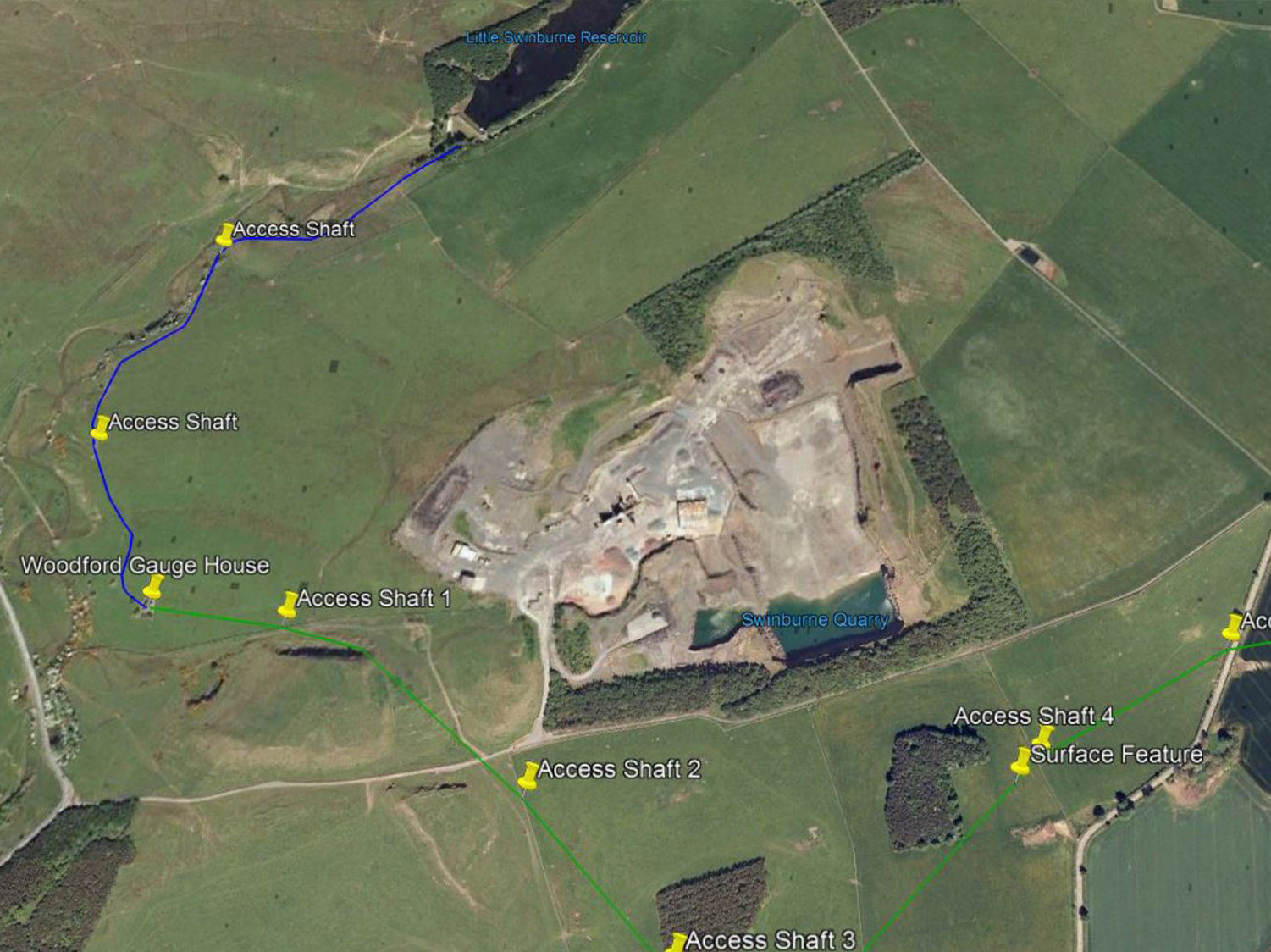
Swinburne Reservoir Pipeline Survey – Inspection and survey of tunnel route
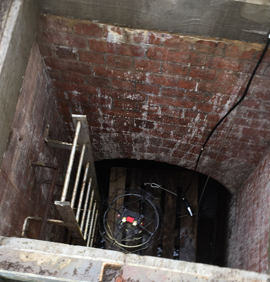
TEXO DSI undertook a series of investigations of 3km of an underground Victorian brick arch tunnel network linking two reservoirs. Manned entry was not possible as there was only a single isolation point for the tunnel with no redundancy.
The investigation was prompted after farmers had noted several areas of their field subsiding along the proposed route, which indicated a suspected collapse as being the cause. In addition, a full visual inspection of the tunnel was recommended to identify potential areas of future collapse.
THE SOLUTION
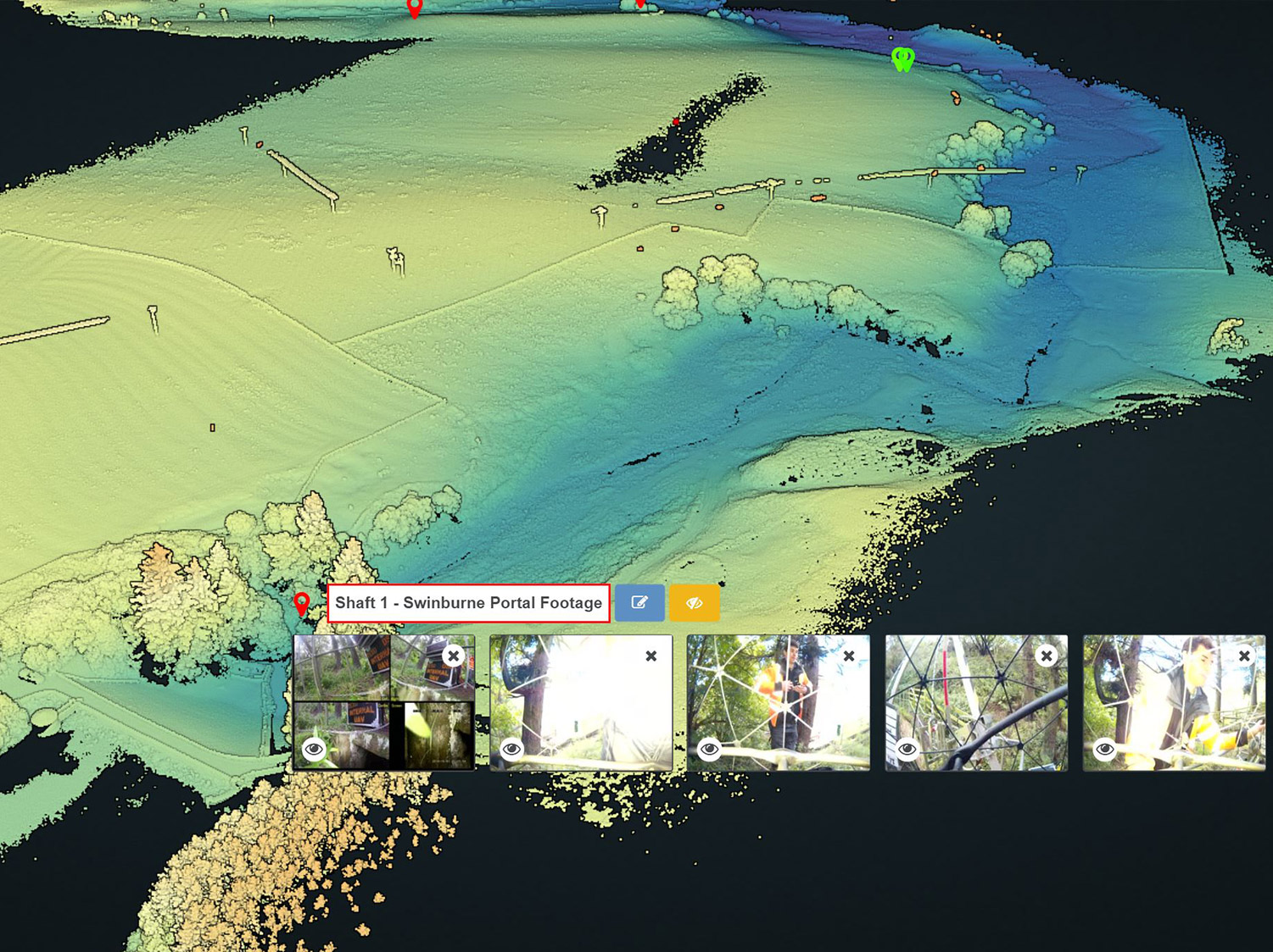
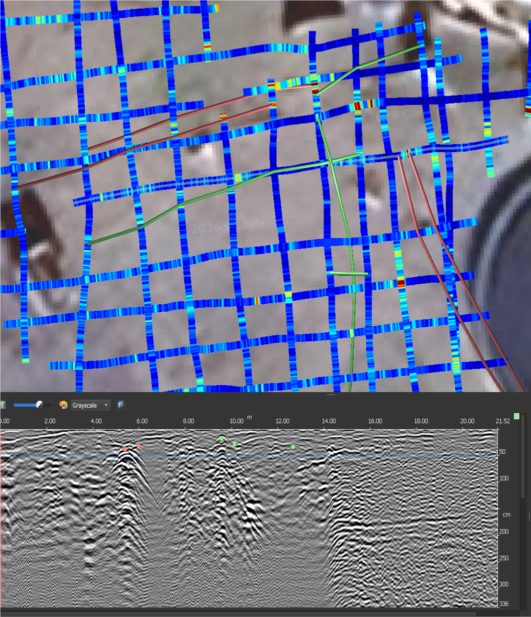
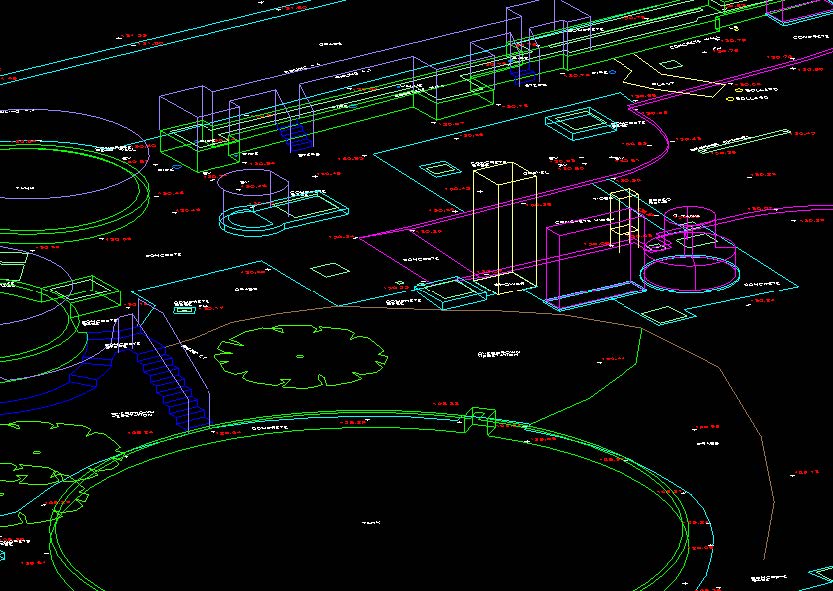
TEXO DSI deployed a multi-disciplined survey team to site to establish a permanent control network, Drone LiDAR, CCTV Crawler inspection, drone inspection within the tunnel and trial several innovative techniques. Prior ground penetrating radar surveys had been conducted and were required to be integrated into the new datasets produced.
The team firstly established 15 permanent control points on-site to establish all subsequent surveys. The second step was to undertake a drone LiDAR scan of the route to enable the profile of the ground beneath the crops and forestry to be established for further deformation modelling.
The team then undertook CCTV crawler inspection with custom camera arrays and deployed drones into the tunnel to survey the roof in more detail than previously provided.
THE RESULT
The initial survey delivered a 12mm accurate point cloud to the client with a point every 5mm enabling an extremely accurate digital surface model to monitor the extent of the subsidence. The further CCTV and drone surveys gave the client new levels of data previously never seen.
Due to the unique ability of the drone to fly along the roof, the client identified several cracks unseen by crawlers and signs of potential failures. Armed with data, the client was able to swiftly enact continuity plans to ensure these key reservoirs were not prevented from supplying water to treatment facilities for major population centres.
With the high detail LiDAR data, all existing data was tagged to the model allowing clients to interact with this digital twin across the project and visualise the site and defects.