Survey & Inspection (DSI)
Colour 3D mobile mapping and UAS capture of highway and roundabouts.
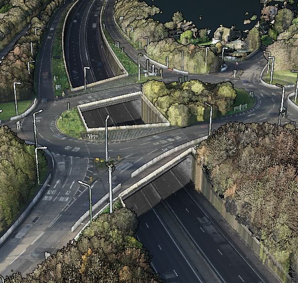
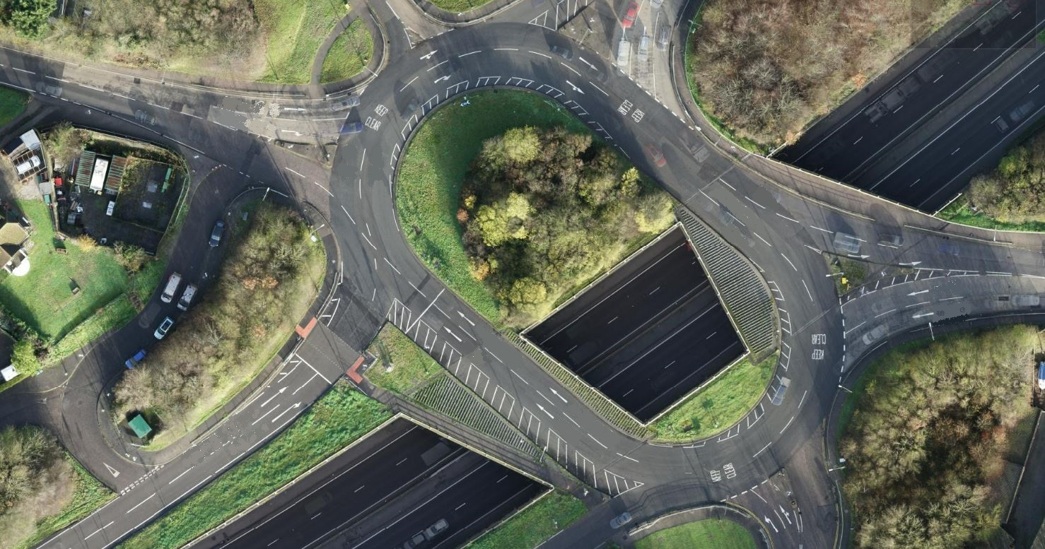
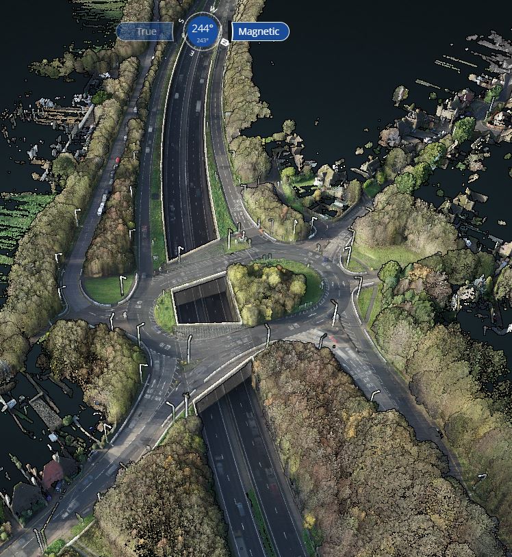
Our client asked us to capture a dual carriageway and two elevated gyratory junctions.
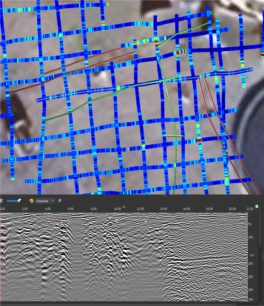
This project needed us to collect accurate 3D topographic information, working within the requirement to minimise traffic management and reference the survey to a wider design area.
SOLUTION
Using a vehicle-based mobile mapping LiDAR system, we collected the highways and junction data without needing to put any traffic management restrictions in place.
UAS photogrammetry was captured over the highways and wider design area, with ground truth checks completed to existing control stations and common survey detail. All data was referenced to the common site grid based on Ordnance Survey National grid and datum.
RESULTS
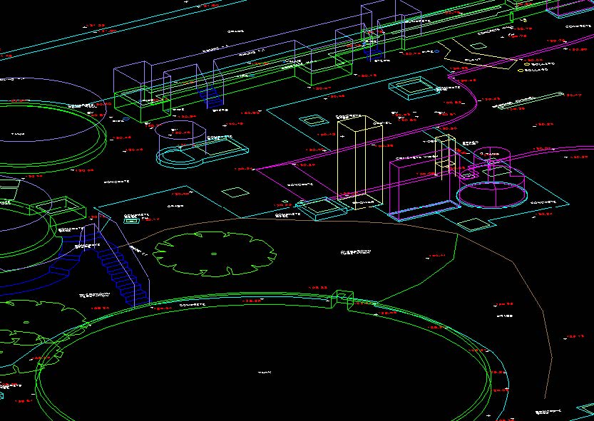
We produced an extensive LiDAR data set which captured highways areas, minimising the need for a ground-based traditional survey.
Multiple returns through nearby vegetation minimised the amount of clearance that was needed to embankments, further reducing the need for traditional survey.
UAS photogrammetry was used to colourise the LiDAR data set, aiding interpretation for the extraction of topographic information. It also allowed us to capture a wide data set across the whole site.